
Winona ZIP Coverage
The official Winona County ZIP-zone map is a broad geography aid. Its December 2021 labels identify the local and surrounding postal zones, while city and county materials verify 55987 for Winona. The map should not be read as a list of city residences or as an address-level delivery ruling. USPS is the source that standardizes an exact address. The table keeps those roles separate so a county zone does not become an unsupported claim about a particular household.
| ZIP | Areas Covered | Post Office | Notes |
|---|---|---|---|
| 55910 | Altura | Altura | Winona County map zone; confirm an exact address with USPS. |
| 55923 | Chatfield | Chatfield | Winona County map label, not a Winona city residential ZIP. |
| 55925 | Dakota | Dakota | Winona County map zone label. |
| 55943 | Houston | Houston | Winona County map zone label. |
| 55947 | La Crescent | La Crescent | Winona County map zone label. |
| 55952 | Lewiston | Lewiston | Winona County map zone label. |
| 55962 | Peterson | Peterson | Winona County map zone label. |
| 55964 | Plainview | Plainview | Winona County map zone label. |
| 55969 | Rollingstone | Rollingstone | Winona County map zone label. |
| 55971 | Rushford | Rushford | Winona County map zone label. |
| 55979 | Utica | Utica | Winona County map zone label. |
| 55987 | Winona | Winona | Verified local city ZIP; USPS remains the address-level authority. |
| 55988 | Residential area not verified | Winona post-office and PO-box association | Do not treat this as a general residential ZIP without USPS confirmation for a particular address. |
The county map uses postal labels to orient a large area. Its surrounding rows are not evidence that those communities are Winona city addresses, and they should never be turned into a broad people list.
Winona ZIP Anchor: 55987
Winona's verified local postal anchor is 55987. That is a useful starting point for Winona mail-address research, but it is not a substitute for entering the full Winona street address into USPS. A Winona street can be near a city edge, a parcel can sit outside a municipal boundary while using a familiar postal name, and a tax mailing address can belong elsewhere. Keep the Winona distinction clear whenever an old newspaper, directory, deed, or family paper gives only a city and ZIP.
The Winona County ZIP-zone map is the official source for the county labels used in the table. It is best used beside, rather than in place of, an address-level postal check.
Winona County ZIP Zones
Altura, Chatfield, Dakota, Houston, La Crescent, Lewiston, Peterson, Plainview, Rollingstone, Rushford, and Utica appear as distinct surrounding labels on the official Winona County map. The useful comparison is Winona County-zone context versus city residence. A Winona County map can show which label lies nearby, while Winona city limits, parcel maps, and delivery service answer different questions. Treat each system as a layer, not as competing proof.
Winona lies in a bluff-and-river landscape where postal geography, municipal lines, and old address references need not line up neatly. A Winona city label in a historical record can therefore be a helpful location clue without resolving the Winona parcel or delivery route. Note: Retain the record's original city line, then verify any current address separately.
What Winona ZIP 55988 Does Not Establish
USPS materials associate 55988 with the Winona post office and PO-box service, but the research did not verify a current Winona residential footprint. That makes 55988 a local Winona postal quirk, not a general residential designation. It should not be used to infer that a person lives in Winona, that a Winona address is served there, or that every location linked to the post office has the same delivery pattern.
Use USPS By Address or By City and State for a particular location. If those results do not resolve the question, preserve the uncertainty and ask the postal service or record custodian for the appropriate channel instead of filling the gap with a county-map assumption.
Confirm a Winona ZIP Code With USPS
USPS offers three separate routes for a Winona address: By Address, By City and State, and Cities by ZIP. By Address is the practical choice when a Winona street is known. It requires a street entry and accepts an optional company, apartment or unit, and entered ZIP, along with city and state. The result supplies standardized Winona postal information, not evidence that a named person or organization occupies the location.
| USPS route | Fields captured in research | What the result can do |
|---|---|---|
| By Address | Street required; city and state; optional company, apartment or unit, and ZIP | Standardize the postal result for an entered address. |
| By City and State | City and state route | Return postal information tied to that city and state query. |
| Cities by ZIP | ZIP route | Show the cities associated with the entered postal code. |
The USPS ZIP lookup is the source for these three routes and its address-standardization caution.
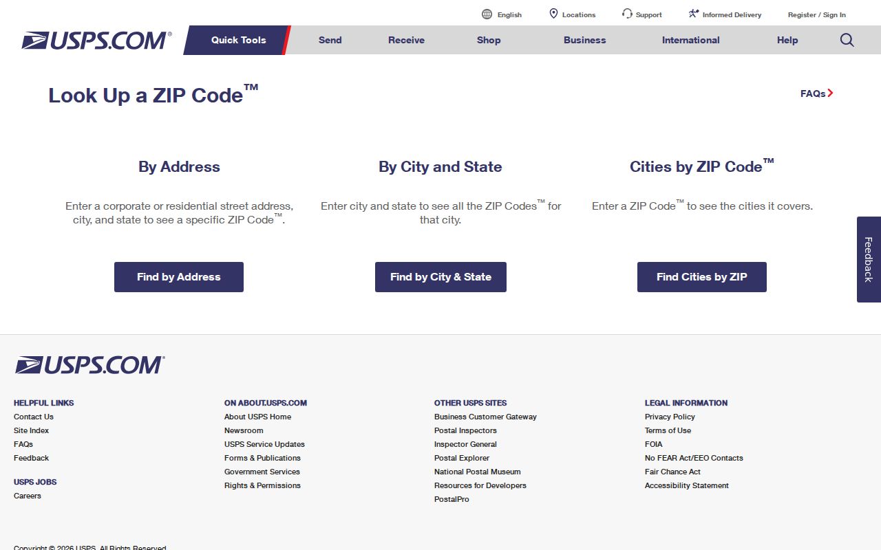
Use the standardized ZIP code output to normalize a Winona address before checking a Winona parcel map, archive catalog, or historical directory, then save the date of the postal check.
Finding Winona Residents Within One ZIP
A ZIP can narrow a Winona address question, but the verified Winona tools do not provide a public ZIP-wide resident roster. MNVotes verifies a submitted person and Winona residence combination one at a time. The Winona County Parcel Viewer and tax route are address or parcel based, not a ZIP-wide owner export. Winona County and city GIS provide parcel and boundary context, while USPS controls the delivery result. These limits matter because a Winona postal match is not proof of current occupancy.
- Enter the known Winona street address in USPS and save the standardized result.
- Use MNVotes only for a person's own name, full date of birth, and Winona residence-address confirmation.
- Use the Winona address or parcel identifier in Beacon or the tax route to review parcel context, not to infer a household.
- Open Winona County or city GIS to compare parcel, city-limit, ward, zoning, or historic-district layers.
- When the question becomes street-specific, use the Winona Streets reference for the address-record workflow.
A lawful voter-file request is a different process with statutory certification and permitted uses. Its availability does not turn MNVotes into an open postal directory.
Winona ZIP Search Fields
MNVotes is the Winona ZIP-capable official form captured in the research. Its ZIP mode routes a single Winona registration check through the address parts, then returns confirmation or next steps for the submitted combination. The service updates nightly, and Winona election officials may take up to 14 days to process a change. A no-match result can be a Winona address, timing, or registration issue rather than proof that a person is absent from the community.
| Field or control | Format | Required | Winona use |
|---|---|---|---|
| First and last name | Letters, spaces, hyphens, apostrophes; no suffixes or diacritics | Yes | Identifies the individual registration check. |
| Birth month, day, and year | All parts entered | Yes | Separates same-name registrations. |
| ZIP | Residence ZIP | Yes in ZIP mode | Routes to the matching city or township. |
| City or township | Dependent dropdown | Yes | Continues the residence match. |
| House number and street | Numbers only for house number; street dropdown | Yes | Completes the address combination. |
| Apartment or unit | Checkbox, then letters, numbers, spaces, hyphen, or slash | Conditional | Required only when the checkbox is selected. |
The MNVotes registration lookup provides this individual confirmation path. It is not a ZIP-wide lookup and cannot be used to compile a public searchable map of voters.
Winona ZIP Boundaries and City Limits
Winona postal boundaries, municipal limits, and parcels have different custodians. Winona County GIS and City GIS show parcels, wards, zoning, historic districts, and city context. USPS sets delivery geography. A Winona parcel's situs address identifies where land is located, while a tax mailing address identifies where correspondence is sent. Neither one alone establishes a person's current home.
The Winona GIS web-mapping application is the source for the city map context described here.
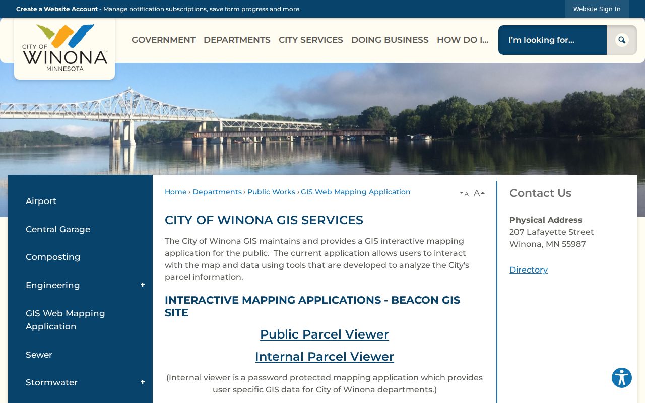
Use the map to place an address among the city's public layers, then return to USPS for delivery and to the appropriate county office for parcel or recorded-document questions.
- ZIP and ZIP+4
- A ZIP identifies a postal delivery area. ZIP+4 adds a more precise delivery segment; it does not identify a household member.
- PO-box ZIP
- A postal code associated with post-office box service. It does not establish a general residential footprint.
- Unique ZIP
- A code assigned to a single organization or high-volume recipient. The term defines a postal category and does not assert one exists in Winona.
- Carrier route
- A delivery grouping used by the postal service. It is not the same as a neighborhood boundary or a person list.
Winona ZIP Code and Parcel Mismatches
Parcel records use additional identifiers. Winona County parcel IDs follow the format xx.xxx.xxxx and are entered as numbers only in the tax-search instructions. A legal description can refer to a lot, block, subdivision, or metes-and-bounds description and may remain stable even when a street label changes. That continuity makes it stronger than a ZIP when tracing property records, but it still does not establish occupancy.
Beacon is intended for owner name, property address, and parcel-number searches. The public viewer's exact live field labels were not verified during the research run, so check the live result before relying on any card field. The County property-tax instructions confirm the address and parcel-ID orientation of this channel.
Winona ZIP History Limits
No official Winona city or county street-renumbering year was found in the research. Minnesota election law requires a municipal clerk to notify the county auditor when street numbers or names change, which is the appropriate bridge when an older address no longer matches. Historical city directories, newspapers, permit requests, cemetery records, and the city's street map with address ranges can offer context, but each has its own coverage and gap limits.
For an old address, keep the date and exact spelling, use USPS for a current delivery check, and ask the city or county custodian about a changed number or street name. The Winona ZIP code directory is a geography reference, not a substitute for the original record.