
Trace a Winona Street Directory
Use an address record trail, not a roster. A Winona address first points to a Winona County parcel. The parcel then supplies an owner name, a parcel ID, and a legal description that can be tested in other Winona records. That sequence is especially useful when an address has a unit, an owner who receives mail elsewhere, or an old Winona street spelling. The strongest answer usually comes from several Winona records that agree on the same property, rather than from a single name associated with a street.
- Enter the exact address in the Winona County Parcel Viewer, also called Beacon, and save the situs address, owner name, parcel ID, and legal description.
- Use the parcel ID and legal description to confirm the property in the Winona County map and to distinguish it from a similarly named street segment.
- Search the current owner as a grantee, or the legal description as a tract, in the Winona County Recorder’s LandShark index. Record the purchase deed and its document number.
- For a named person and a lawful personal purpose, use MNVotes only to confirm that submitted name, birth date, and residence-address combination. It is not a street-browsing tool.
- For an older household, ask Winona Public Library or the Winona County Historical Society whether the relevant directory volume has a street section, then compare it with newspaper and census evidence.
Each Winona handoff narrows a different issue: property identity, transfer history, one-person registration, or a historical household. The result can establish a documented association with an address, but it should not be used to infer every person who may be present there.
Winona Street Record Identifiers
Four labels commonly appear around one Winona address. They should be copied separately before a street-by-street search moves into deeds or older material. The Winona Assessor’s tax instructions use a parcel or property ID in the format xx.xxx.xxxx, entered as numbers only. That identifier and the legal description are often more durable than a Winona street label when a map, directory, or document uses a different form of the address.
- Parcel
- A defined piece of land used for assessment and tax administration. Its ID connects the map, Beacon, and tax material.
- Situs address
- The physical address assigned to the parcel. It is different from the address where an owner receives correspondence.
- Plat
- A recorded subdivision map that can identify a lot and block. It helps connect a street address with its legal description.
- Criss-cross directory
- An address-oriented directory arrangement. Winona’s separate reverse-directory run was not verified, so ask whether a particular historic volume includes a street section.
A Winona tax mailing address is not proof that an owner lives at the situs. Likewise, a Winona homestead flag is a tax classification, not conclusive evidence of present occupancy. These distinctions keep the address search grounded in what the source actually identifies.
Note: When a street label conflicts with a deed, preserve the parcel ID and legal description before treating either wording as decisive.
Search Winona Addresses in Beacon
The Winona County Parcel Viewer is the practical starting point for a current Winona address. Winona County research documents three intended search routes: owner name, property or situs address, and parcel number. The dynamic interface was not fully text-inspectable, so its exact live labels and every result-card field should be checked in the viewer. Still, the County’s documented search schema makes clear which values to carry into the next record.
| Beacon field or action | Type | Required | Winona use |
|---|---|---|---|
| Owner name | Text search | Optional route | Find Winona parcels associated with an owner name; check spelling and co-owner display in the live viewer. |
| Property or situs address | Text search | Optional route | Search a standardized Winona street number and name. |
| Parcel or property ID | Text search | Optional route | Use the Winona County format xx.xxx.xxxx, with numbers only. |
| Map or layer selection | Map control | Optional | Select a Winona parcel and move to its property details. |
| Result card | Record view | After a match | Expect Winona property and assessment context, while confirming current fields in Beacon. |
| Tax statement link | Link | After a match | Recent Winona tax statements may be linked from Beacon. |
The County property-tax instructions show the parcel-ID rule used with the tax search. Save the ID exactly, including its separators when recording notes, even though the search input asks for numbers only.
The County property-tax search instructions appear below as captured for a Winona address search.
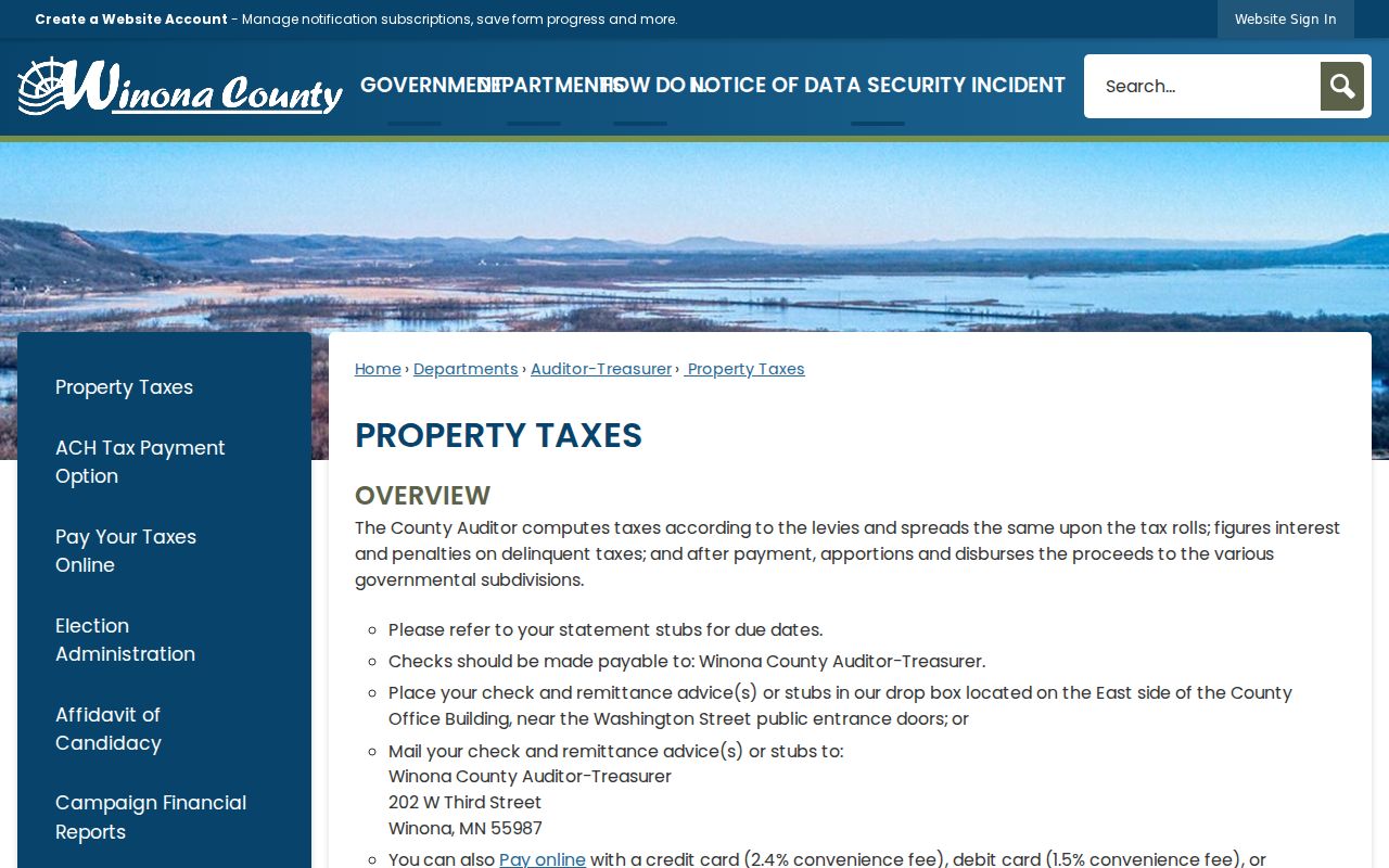
The instructions reinforce the parcel format that bridges a street address to the tax and property record. They do not establish that every listed owner occupies the address.
Map a Winona Street Segment
The Winona County mapping applications and LandShark map can add the spatial layer that a property card cannot. Search an address or parcel, turn on the parcel layer, and use zoning, flood, district, or other thematic layers to understand the setting. A click on a nearby polygon can reveal the next parcel to inspect. This is useful for following a named street in sequence, provided each parcel is then verified in Beacon or LandShark.
The Winona map has an important limit: research found adjacent-polygon clicking and panning, but no verified radius or buffer tool. Winona County and City GIS also disclaim legal-boundary and survey use. A visible line is context, not title evidence, and a cluster of parcels is not proof that each parcel is occupied.
Winona County’s mapping-applications page is the source for this Winona map route.
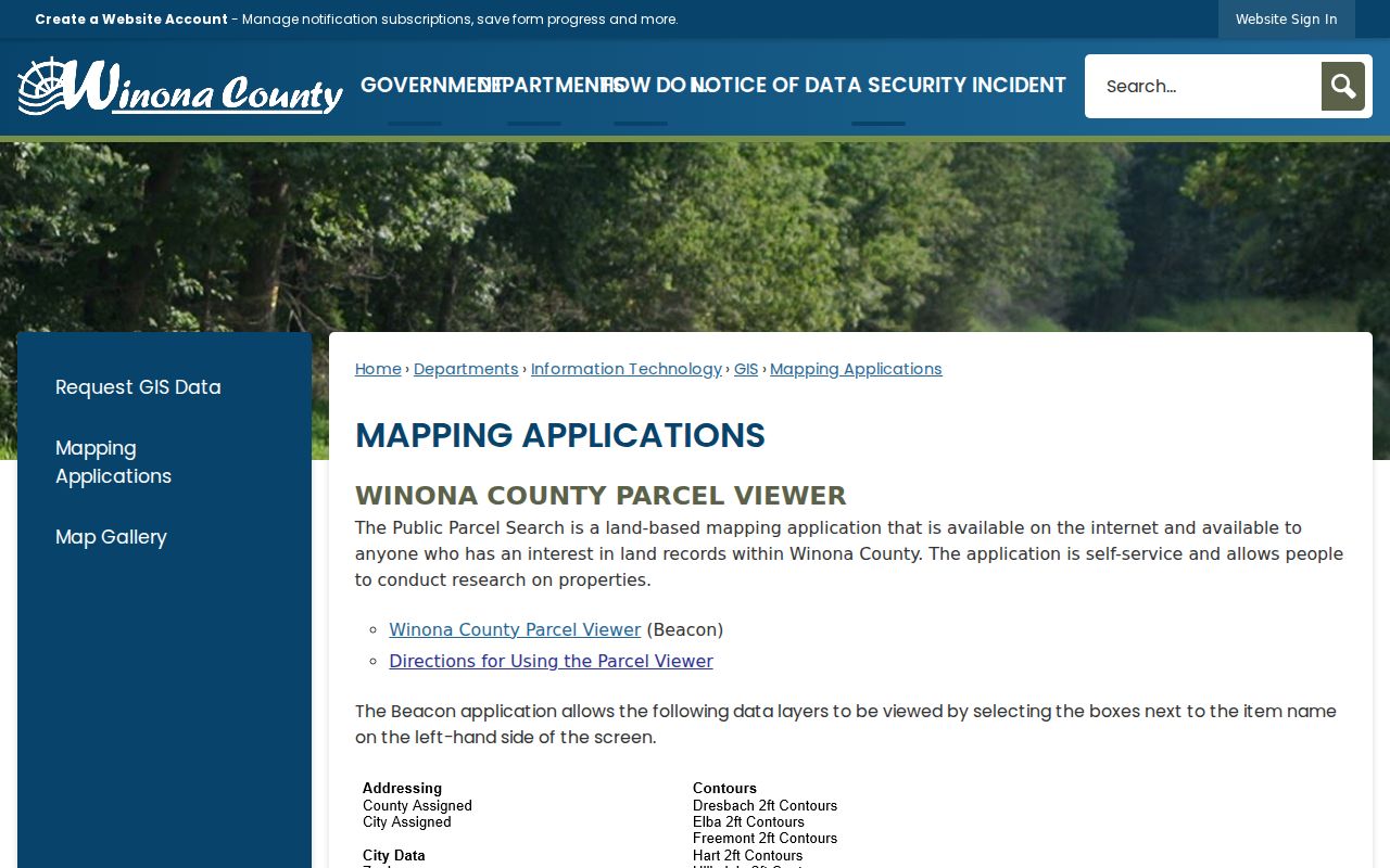
Use the displayed application links to move from a street view to a parcel record, then document the parcel ID instead of relying on the map image alone.
Note: Adjacent parcel browsing helps organize a street review, but Winona GIS is not a verified radius search or a legal boundary source.
Winona Street Directory Records
Different Winona address-keyed sources answer different questions. The table keeps Winona ownership history, map context, permits, historical directories, and voter confirmation in their proper lanes. It also shows why a property search should not collapse a parcel owner, a permit applicant, and a resident into the same identity.
| Address-keyed source | What it can show | Winona keeper and access |
|---|---|---|
| Winona Beacon parcel card | Parcel owner, mailing and situs addresses, ID, legal description, and assessment, tax, or building context. | Winona County Assessor; public viewer intended, with dynamic live-card fields. |
| Winona County GIS | Parcel geometry, map layers, districts, surveys, and surrounding context. | Winona County GIS; public map with a no-legal-survey disclaimer. |
| Winona LandShark deed index | Grantor, grantee, document and date, legal description, and chain of title. | Winona County Recorder; online dates vary, with an office fallback. |
| Winona City permit file | Address, permit activity, owner, applicant, contractor, and inspection history if public. | Winona City Inspections; request-based because no public history lookup was found. |
| Winona City code or enforcement file | Address and public portions of a complaint, action, or inspection. | Winona City data request; classification varies by record. |
| Winona voter record | Registration status and address for a named person who supplies the required match information. | MNVotes or a lawful voter-file request; not open street browsing. |
| Winona city directory | Historical occupant and address, plus possible occupation or household notation. | Winona Public Library and WCHS, with 1866 or 1872-present runs and gaps. |
| Winona tax roll | Situs, mailing address, taxable value or classification, and tax status. | Winona County Auditor-Treasurer and Beacon. |
The Winona table is a starting inventory, not a list of interchangeable proof. A mailing address may belong to an agent, trust, business, or owner who lives elsewhere. A Winona directory entry can be a business or boarding address. Match names, dates, legal descriptions, and document numbers before making a historical connection.
Winona Deed Index by Era
LandShark is the ownership-history bridge for a Winona street trail. The Winona County Recorder documents several routes: Tract, Grantor/Grantee Index, Vol/Page, Document Number, and Map. Start with the current owner as grantee or with the legal description as a tract. Open the purchase deed, capture its grantor, grantee, recording date, document number, instrument type, legal description, book or page reference, and any linked image. Then search the seller as grantee for the earlier purchase.
| LandShark record path | Documented Winona coverage | Best fallback |
|---|---|---|
| Winona abstract data | September 1, 1987 to current records. | Use the Winona Recorder or office computers for gaps. |
| Winona abstract tract books | September 1979 through June 1999. | Use the Winona tract route with the legal description. |
| Winona grantor and grantee index | 1938 through 1984. | Search Winona names with the parcel continuity in view. |
| Winona abstract images | Document number from May 16, 1967 forward; earlier images by volume and page. | Switch from document number to Vol/Page for an older image. |
| Winona Torrens material | Data from September 1, 1987; images from June 29, 1911 forward. | Call the Winona office for certificates that are not online. |
This mixed Winona coverage is a useful comparison point. A missing remote image does not mean the recording is missing. Some records can be viewed on Winona public office computers, and remote enhanced access may require an agreement, account, and applicable fees. The Recorder’s LandShark page is the right place to confirm the route before requesting a copy.
Note: Search the deed chain by legal description as well as name, because one seller may have held more than one parcel.
Winona Permit Records by Address
Winona permit and inspection material can date changes at an address, but it is not a ready-made public history screen. The City of Winona posts applications, fee information, and inspection responsibilities. Research did not locate a public permit-history lookup. For a specific Winona street address, ask the City for permits, inspections, owner, applicant, contractor, and code-enforcement records, and include a date range. The Winona record custodian can then identify what is public, private, or redacted.
The Winona County Assessor page identifies the property-valuation entry point that should be checked before making a narrower City request.
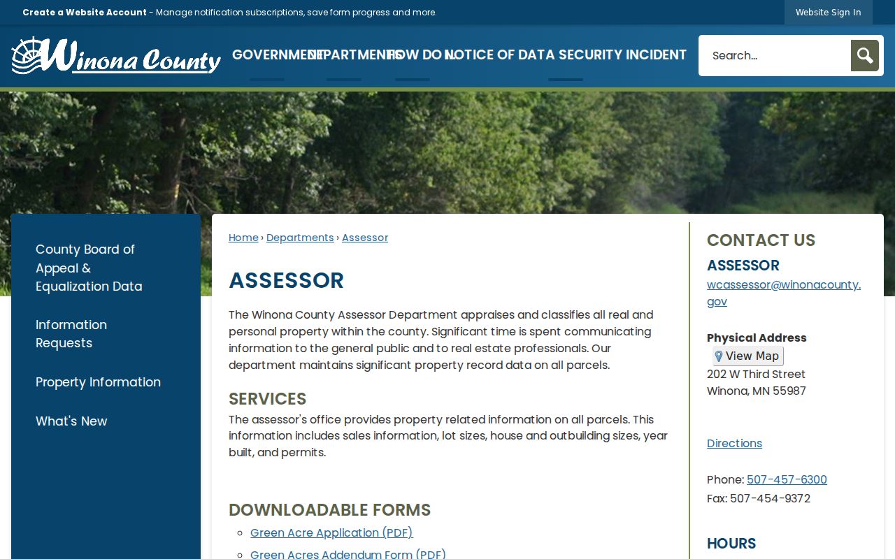
The Assessor resource is a parcel starting point, while City permit material needs a request keyed to the exact address and time span.
Under the Minnesota Government Data Practices Act, ask for inspection or copies from the custodian and describe the record type, property, and period. A request is more effective than guessing from an absent online search result.
Winona Voter Records by Street
MNVotes is a one-person registration confirmation, not a Winona street-wide lookup. It requires first name, last name, month, day, and year of birth, then uses a Winona residence address through ZIP or county mode. In ZIP mode, the user supplies ZIP, city or township, house number, and a street selected from the address list. A matching result can confirm registration and provide voting links. It cannot be used to browse everyone associated with a street.
Minnesota’s public voter information list has separate rules under Minn. Stat. §201.091. A lawful requester must meet the statutory purpose and certification requirements. The state request form offers a street-sorted walking-list format, but that does not authorize searchable Internet republication, selling, loaning, or sharing outside permitted uses. Full dates of birth and other protected identifiers are not public-list fields.
Note: If MNVotes reports no match, use its stated next steps or the County election office instead of treating the result as a finding about a street.
Verify a Winona Street ZIP
Postal geography and parcel geography do not always match. The County ZIP-zone map anchors 55987 to Winona city, but the County map is a broad geography aid rather than a delivery guarantee. USPS is the authority for a particular address. Its lookup offers By Address, By City and State, and Cities by ZIP modes, and it warns that a ZIP result does not confirm a person or company at the address.
Use the USPS ZIP Code Lookup after normalizing the address, especially before submitting MNVotes address fields. Research also found a Winona post-office or PO-box association for 55988, but did not verify its current residential footprint. Do not treat 55988 as a citywide residential ZIP without an address-level USPS result.
Winona Street Directory History
For an older address, the property trail may need a historical directory, newspaper, map, or custodian request. Winona County Historical Society reports city directories from 1866 forward, and Winona Public Library reports directories from 1872 forward with some missing years. The research did not verify a separate Winona reverse-directory title or its years. Ask whether the exact volume includes a street section before assuming it can identify an occupant from an address.
Do not assign a Winona renumbering or street-renaming year. Official research did not find one. If an old label no longer matches, preserve the legal description, parcel ID, plat, directory year, and any street-range context. Minnesota law requires municipal clerks to notify the county auditor when street names or numbers change, making the City or County a sensible bridge for an unresolved label. Historical directory collections are discussed in more depth on the Winona City Directory page.
Winona Street Directory Privacy Limits
Address records have firm boundaries. Non-owner occupants, children, utility customers, delivery recipients, visitors, and many other household members cannot safely be inferred from a parcel owner or a deed. A police, juvenile, protected-voter, court, or DMV record has separate restrictions. Safe at Home participants can use a substitute address, and that protection should never be reverse-engineered. If an address produces a gap, the appropriate next step is the named custodian or a lawful request, not a broader claim.
Lawful use. Winona street and parcel records support personal, lawful research and property history. Minnesota law prohibits harassment or stalking, so never use an address trail to monitor, intimidate, or contact someone against their wishes.
An address trail can help organize Winona public records. It cannot confirm a private household, a person’s present whereabouts, or the legal boundary of a parcel.